The Interpolate Elevations feature is available in both the KYnetic and Classic Interfaces. It uses existing elevation data to update nodes with missing elevation data. This feature can be found in the Internet Maps Menu under the Elevations/Addresses Tab.
Interpolate Menu
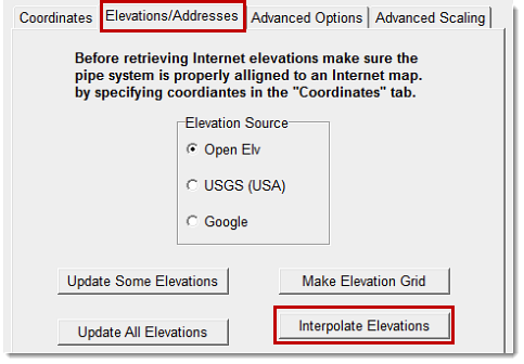
Zero elevations represent missing data. These are replaced using elevation data interpolated from surrounding nodes with non-zero elevation values.

After missing node elevation data are updated, elevation contours are applied. If the model currently has contours, these are replaced with the elevation contours.